| ActiveMac | Anonymous | Create a User | Reviews | News | Forums | Advertise |
|
|
|
User Controls |
|
New User |
|
Login |
|
Edit/View My Profile |
|
|
|
|
|
|
|
ActiveMac |
|
Articles |
|
Forums |
|
Links |
|
News |
|
News Search |
|
Reviews |
|
|
|
|
|
|
|
News Centers |
|
Windows/Microsoft |
|
DVD |
|
ActiveHardware |
|
Xbox |
|
MaINTosh |
|
News Search |
|
|
|
|
|
|
|
ANet Chats |
|
The Lobby |
|
Special Events Room |
|
Developer's Lounge |
|
XBox Chat |
|
|
|
|
|
|
|
FAQ's |
|
Windows 98/98 SE |
|
Windows 2000 |
|
Windows Me |
|
Windows "Whistler" XP |
|
Windows CE |
|
Internet Explorer 6 |
|
Internet Explorer 5 |
|
Xbox |
|
DirectX |
|
DVD's |
|
|
|
|
|
|
|
TopTechTips |
|
Registry Tips |
|
Windows 95/98 |
|
Windows 2000 |
|
Internet Explorer 4 |
|
Internet Explorer 5 |
|
Windows NT Tips |
|
Program Tips |
|
Easter Eggs |
|
Hardware |
|
DVD |
|
|
|
|
|
|
|
Latest Reviews |
|
Applications |
|
Microsoft Windows XP Professional |
|
Norton SystemWorks 2002 |
|
|
|
Hardware |
|
Intel Personal Audio Player 3000 |
|
Microsoft Wireless IntelliMouse Explorer |
|
|
|
|
|
|
|
Site News/Info |
|
About This Site |
|
Affiliates |
|
ANet Forums |
|
Contact Us |
|
Default Home Page |
|
Link To Us |
|
Links |
|
Member Pages |
|
Site Search |
|
Awards |
|
|
|
|
|
|
|
Credits |
|
|
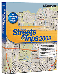
Microsoft Streets & Trips 2002 Technology Simplifies Travel Planning | |
| Time: 16:41 EST/21:41 GMT | News Source: Microsoft Press Release | Posted By: Julien Jay | ||

Microsoft’s Streets & Trips 2002 software is a consumer package that loads onto virtually any desktop PC. It provides detailed and comprehensive information on routes, points of interest, restaurants and lodging, expected travel times -- with gas costs incorporated, so you know how much the trip will cost -- even updates on construction areas along the way. These maps can be printed, in multiple formats, directly from the desktop. Streets & Trips 2002 also includes Pocket Streets, an extension that runs on Pocket PC handheld devices. This allows travelers to carry far more information on a device that takes up less space than a stack of maps and doesn’t require folding. Streets & Trips incorporates detailed mapping of more than 6.4 million miles of local, city, state and highway roads in the United States and Canada -- representing more than 35,000 US zip codes and over 700,000 Canadian postal codes. Streets & Trips 2002 supports GPS, meaning users can pinpoint their location anywhere in the United States and Canada. The built-in Web interface enables two other key functions. The features and functions in Streets & Trips are not limited to the United States and Canada. European travelers get the same information in a sister product called Auto Route 2002 . | ||
|
Write Comment
Return to News |
Displaying 801 through 805 of 805 Prev | First |
The time now is
11:54:07 AM
ET.
Any comment problems? E-mail us |
| #802 By 4240821 (94.242.58.201) at 2/17/2026 3:43:16 PM |
|
https://telegra.ph/Elbe-Ijsblokken-Threaten-River-Traffic-Iceberg-Alert-Issued-01-20
https://telegra.ph/Johnny-Depps-Legal-Battles-Whats-Next-for-the-Hollywood-Icon-01-20 https://telegra.ph/Met-Éireann-Issues-Stark-Warning-as-Freak-Weather-Event-Looms-01-20 https://telegra.ph/Local-Politician-Accused-of-Dumping-Gross-Defamation-in-Heated-Exchange-01-20 https://telegra.ph/Hubert-Hurkacz-Serves-Up-a-Slam-Dunk-of-a-Win-01-20-3 https://telegra.ph/San-Sebastiáns-Culinary-Scene-Ignites-A-Taste-of-Basque-Brilliance-01-20 https://telegra.ph/Raphaël-Collignon-Dominates-01-20 https://telegra.ph/Alessandra-Sublet-Bares-All-The-Unfiltered-Truth-Behind-Her-Bold-Career-Moves-01-20 https://telegra.ph/Child-Benefit-Ireland-Big-Changes-Ahead-for-Families-01-20-2 https://telegra.ph/Cathie-Wood-Bets-Big-ARK-Invest-Dumps-Tesla-Buys-THIS-AI-Disruptor-01-20 |
|
Write Comment
Return to News |
Displaying 801 through 805 of 805 Prev | First |
The time now is
11:54:07 AM
ET.
Any comment problems? E-mail us |